Preparation Workflow
This page describes the steps to execute to manually prepare the files required to run an analysis.
Normally the bna prepare command (or bna run) would execute all the actions
automatically, but there can be some edge cases where the tool is not able to
complete them all, therefore requiring the user to finalize them by hand.
Steps
This example will depict the process for the city of Valencia, Spain.
Retrieve the city boundaries
The first step consists in retrieving the city boundaries.
For this we’re using the OSMNX library.
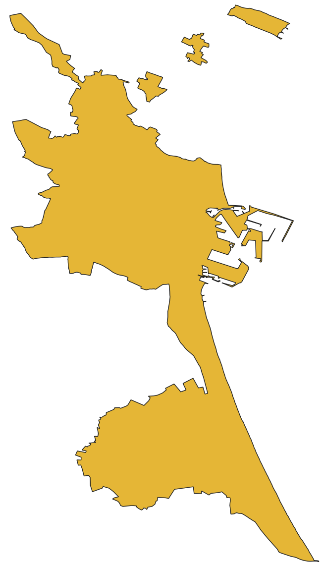
Administrative boundaries of the city of Valencia, Spain.
Download the OSM region file
Then we need to download the OSM planet file for the region where the city is located.
We can retrieve these files on the Geofabrik.de site. They are orgranised by continents, regions, countries, and even some times cities themselves.
We will need to download the valencia-latest.osm.pbf file from the page of the
region of Valencia.
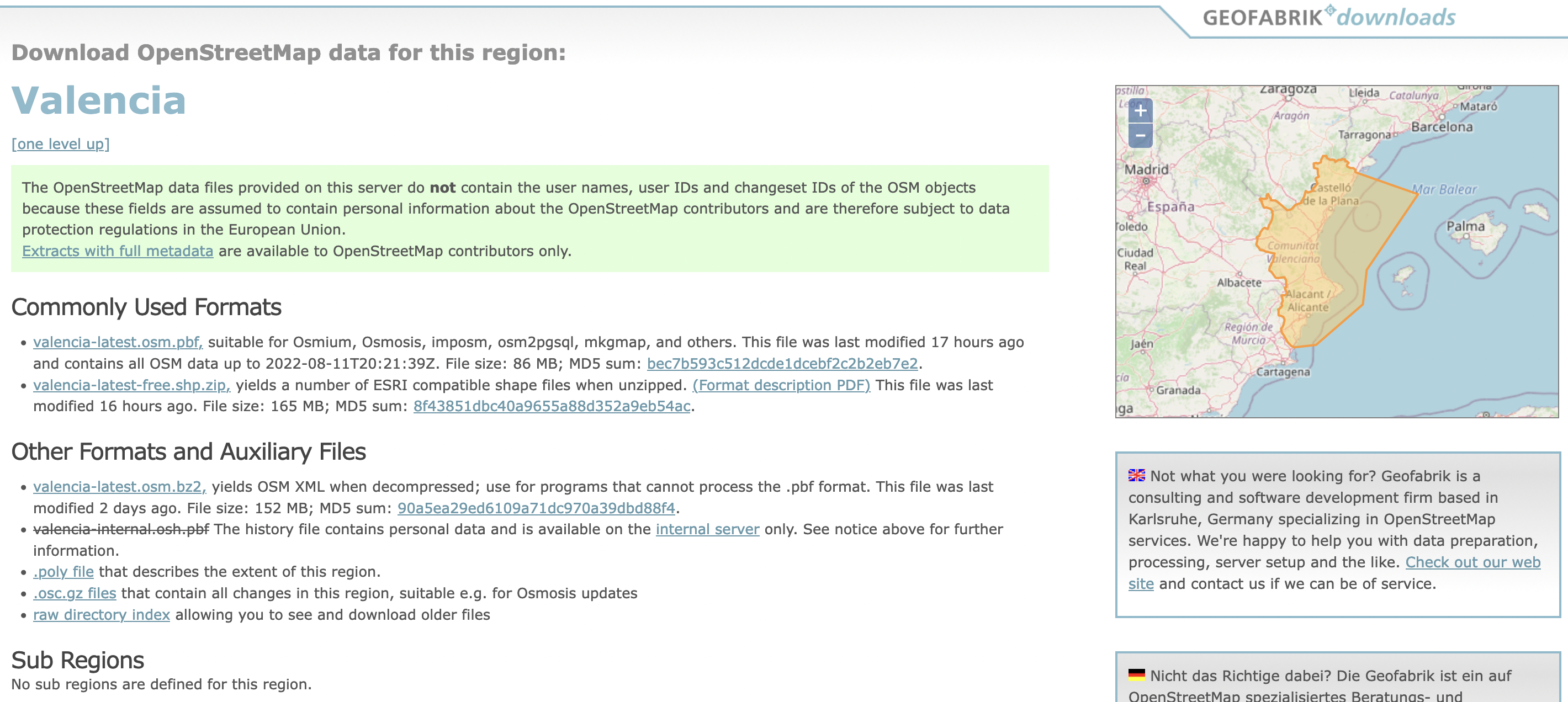
Comunidad Valenciana, Spain on Geofabrik.de.
Reduce the OSM file to the city limits
Once we have both pieces, we can use them to extract the information from the planet file, which are contained within the city limits.
This is done using a tool like osmium. We will use it to generate a file named
valencia-spain.osm.
Note
In a future version, these 3 steps will be combined.
Retrieve US state information
If the city is located in the US, we need to retrieve the FIPS State Numeric Code andthe Official USPS Code (i.e. abbreviation).
For example, the state of Texas is abbreviated “TX” and has a FIPS code of 48.
This information can be found on the census page.
For non-US cities, an abbreviation of “ZZ” is used, and a FIPS code of 91.
Extra steps for non-US cities
For non-US cities we need to simulate the information from the US census.
Create synthetic population
We need to create a grid which just overlaps the city boundaries. Each cell of the grid will contain the same amount of population.
In our case, each cell is a square of 1000m x 1000m, and contains 100 people.
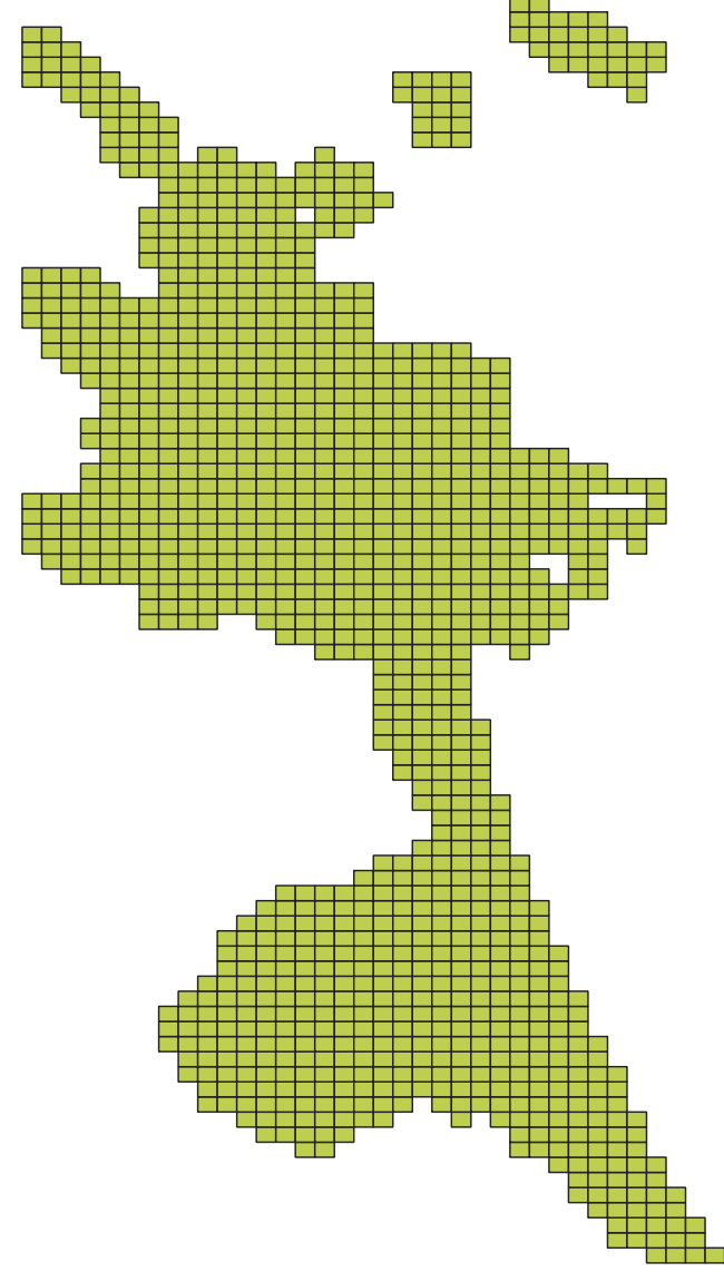
Synthetic popupaltion for Valencia, Spain
Simulate census blocks
This grid then needs to be exported to a shapefile, zipped without a top level folder. This will simulate the census dataset representing Census Blocks with Population and Housing Counts.
This file must be named tabblock2010_91_pophu.zip and stored in the data
directory.
Adjust default speed limit
Default speed limits are different in each country, and infering them from Open Street Map is not always possible.
In this case, a CSV file overriding the default values must be created with the following format:
city,state,fips_code_city,speed
valencia,al,0000000,50
This file must be named city_fips_speed.csv and stored in the data
directory.
Final results
At the end of the process, the ./data folder should contain the following
files:
./data
├── city_fips_speed.csv
├── spain-latest.osm.pbf
├── tabblock2010_91_pophu.zip
├── valencia-spain.cpg
├── valencia-spain.dbf
├── valencia-spain.geojson
├── valencia-spain.osm
├── valencia-spain.prj
├── valencia-spain.shp
└── valencia-spain.shx
You can then run the analysis with the following command:
bna analyze spain valencia valencia-spain.shp valencia-spain.osm
After several hours (7+ hours), the result will be generated in a subfolder of
the data directory and will look like this:
.
├── neighborhood_census_blocks.geojson
├── neighborhood_census_blocks.zip
├── neighborhood_colleges.geojson
├── neighborhood_community_centers.geojson
├── neighborhood_connected_census_blocks.csv.zip
├── neighborhood_dentists.geojson
├── neighborhood_doctors.geojson
├── neighborhood_hospitals.geojson
├── neighborhood_overall_scores.csv
├── neighborhood_parks.geojson
├── neighborhood_pharmacies.geojson
├── neighborhood_retail.geojson
├── neighborhood_schools.geojson
├── neighborhood_score_inputs.csv
├── neighborhood_social_services.geojson
├── neighborhood_supermarkets.geojson
├── neighborhood_transit.geojson
├── neighborhood_universities.geojson
├── neighborhood_ways.zip
└── residential_speed_limit.csv